About the Huts

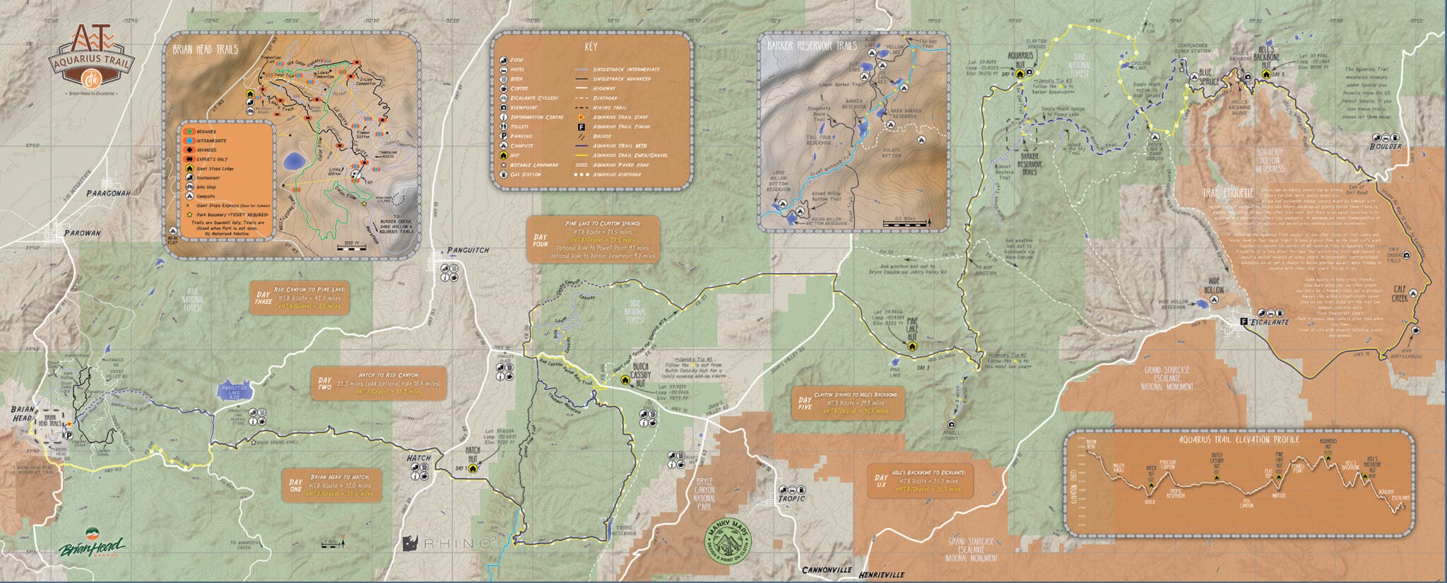
The Aquarius Trail Hut System provides and supports a backcountry experience like no other! A system of five huts are strategically placed along a 190 mile route through some of Utah’s most scenic backcountry – spanning from the peak of Brian Head at 11,307’ to the beautiful town of Escalante at 5,820’. The section of Utah called “Color Country” includes many well-known attractions such as Powell Point, Brianhead Ski Resort, Red Canyon, Aquarius Plateau, Dixie National Forest, the Hogback, Escalante National Monument, spectacular views riding past Bryce Canyon National Park, and much much more!

Photo Credit: The Radavist

From the seat of your bike, you’ll enjoy remote hut accommodations, purpose-built as well as wild singletrack, challenging jeep tracks, dirt roads, hidden lakes, and spectacular vistas. E-bikes are allowed at each hut so groups of mixed abilities can enjoy the same adventure. Our huts provide a bikepacking experience with backcountry comforts; complete with foot pump rinse stations, solar power for charging electronic devices, fully stocked kitchens with a refrigerator and freezer, lighting, hammocks, large decks, Forest Service-approved pit toilet bathrooms, bicycle repair tools and stands, playing cards, fire pit, cozy sleeping arrangements, and more.

Construction and Facilities

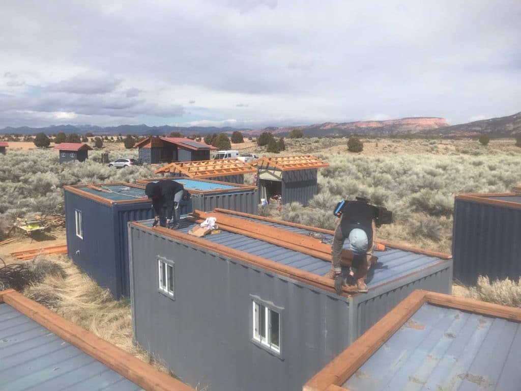
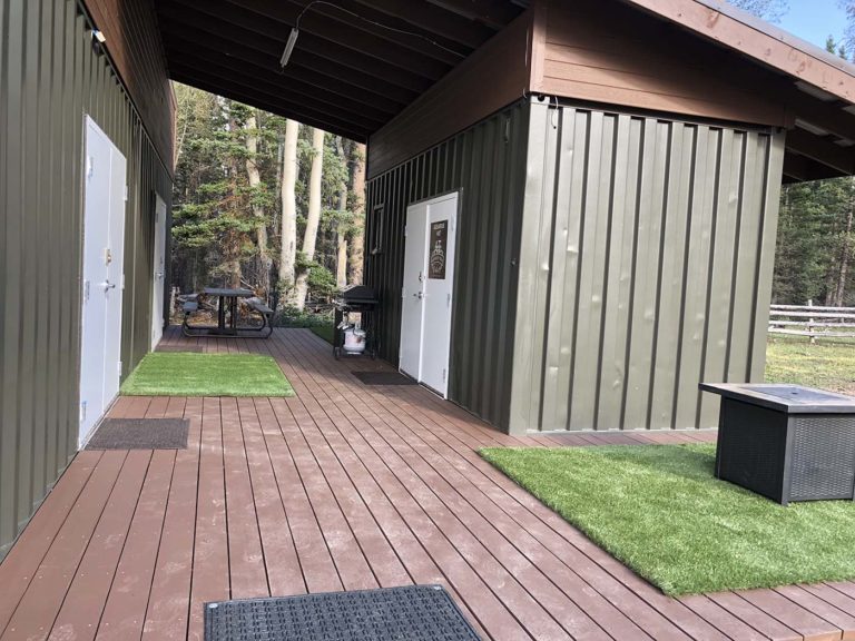
These unique huts are built using repurposed high-top (9′ 6″) shipping containers. These containers were used across the Pacific Ocean to haul commercial goods. Once retired they made their way to Phoenix Arizona where they were cut apart into 20 foot sections, and constructed with interior walls similar to what you would find in a new home. The containers were then shipped to Nevada where they were furnished with complete kitchens, foot pump body rinse stations, and bedrooms.

They were designed to be off grid so that they could be located in off-the-beaten-path locations. The kitchen sink, hand washing station, and body rinse stations utilize manual foot pumps. The cooking stove was designed to run off propane and the refrigerator was designed to run off solar power with back-up batteries.

Aquarius Trail Hut Shipping Containers
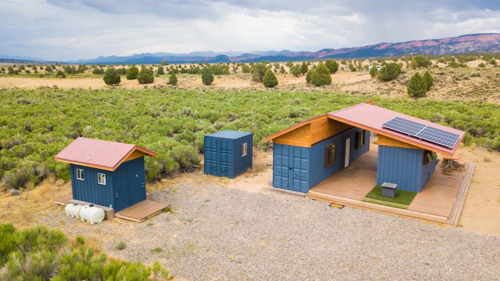
Aquarius Trail Hatch Hut from above

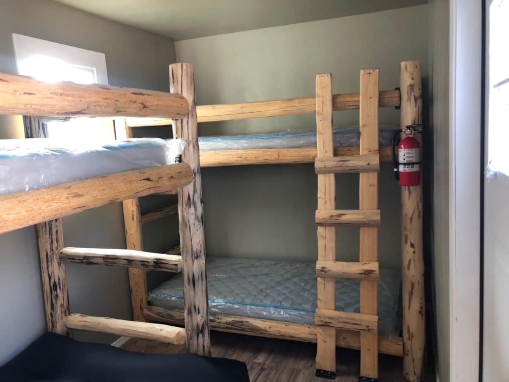
The huts are constructed with two sleeping cabins – 6 beds in each cabin. Each unit and the kitchen have electronic charging outlets to charge phones and small electronics. The separated bathroom unit and storage is equipped with a pit toilet and hand washing station. The storage area has a generator (to charge ebikes), bike stands, extra water storage, propane storage, and other hut supplies.

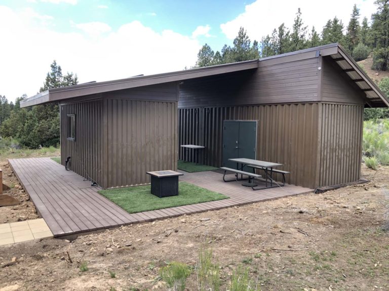
Each completed hut was built with an enormous deck and customized roof to house the solar PV panels. The huts are extremely solid, safe, nicely insulated, and fully ready to house the adventure traveler! 

Cuisine

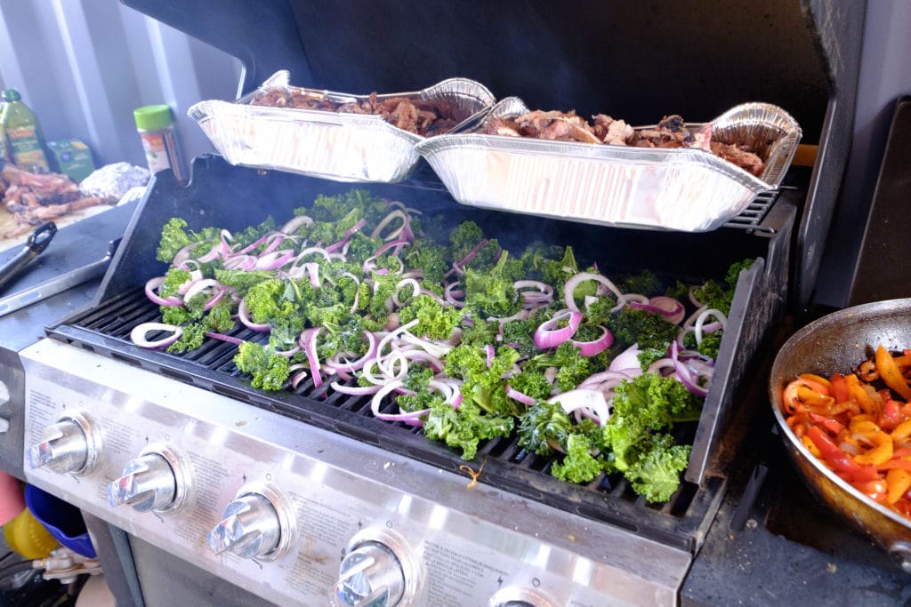
Because each unit is equipped with a fully functional refrigerator and freezer, the Aquarius Trail Hut System is stocked with a variety of non-perishable foods and fresh, healthy foods and ingredients to whip up a curated dinner menu for each stop on your trip. This includes cold drinks. Vegetarian and Gluten Free options are provided at each hut and we even stock beer for a small fee.

Amenities

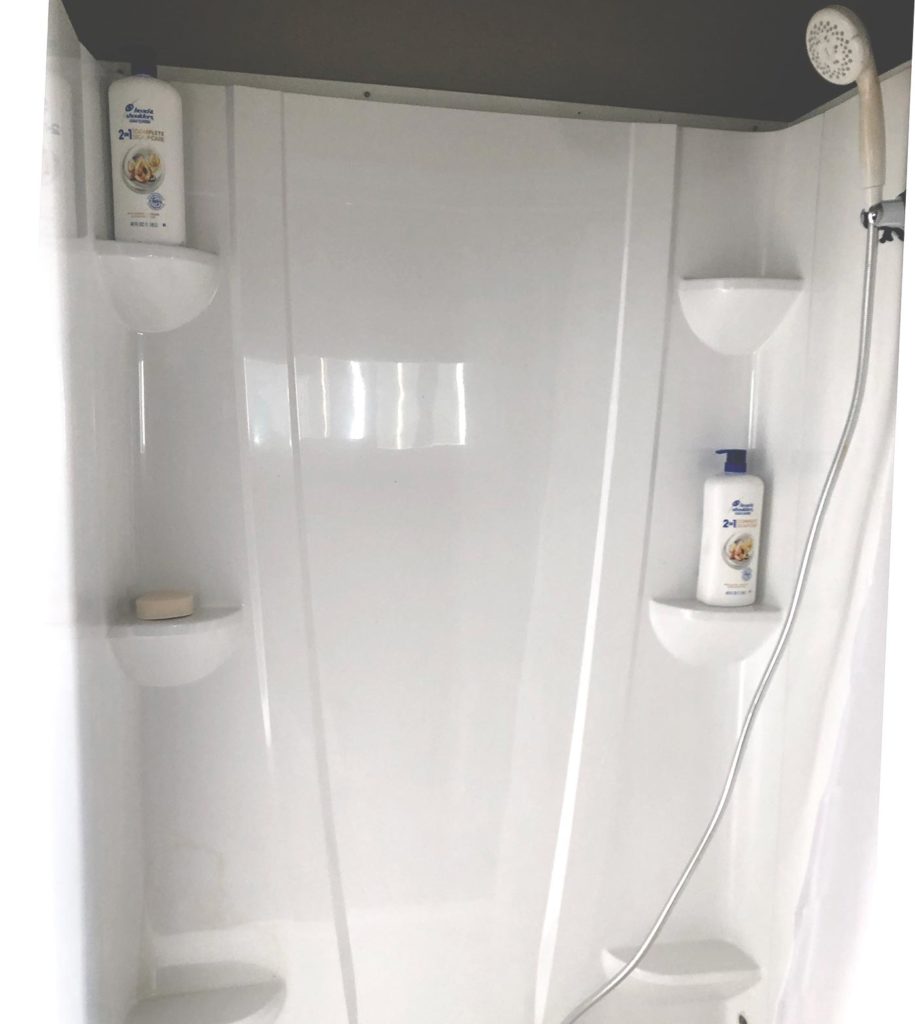
Forest Service-approved pit toilet bathrooms and body rinse stations are available at each hut. The body rinse stations utilize outside temperature water, but if needed one can heat water on the stove to create a warm rinse. On the surrounding deck you will find sections of turf to spread out on, lazy chairs, and space to hang the two supplied hammocks. Additionally, there is a propane fire pit to roast marshmallows or just hang out and tell stories of the day’s adventure.

Accommodations

Bunk beds in each hut can accommodate 12-14 riders (each hut has two sleeping units with three bunk beds in each unit. One of the bunk beds folds out into a futon that can sleep two people) Bedding/towels are provided at each location. Have more questions? View our Frequently Asked Questions.

If you are booking the entire route, you need to book between July 1 – Mid October due to snow fall at higher elevations.

Hatch Hut

Elevation: 7027 ft.
Season: May 1 – End of October
About the Area: Hatch, Utah is part of the Headwaters section of the National Mormon Pioneer Heritage Area. The original homestead was established in 1872 near the mouth of the Asay Creek. It was named Hatch after one of its founding members and was incorporated in 1934. The current population of Hatch is 130 people.

Hatch offers excellent fishing, mammoth and Asay Creeks, the headwaters of the Sevier River, are stocked with rainbow, german brown and cutthroat trout. THe Mammoth Creek Fish Hatchery is located just a few miles southwest of Hatch. When in operation, the hatchery is responsible for sticking catchable rainbow trout in area waters.

North of Hatch at the junction of US-89 and Scenic Byway 12 is scenic Red Canyon. Many miles of hiking, biking and horse trails are located within the canyon. Butch Cassidy, the famous outlaw, used this area as a hideout between Panguitch and Hatch. Just 25 miles from this location, following Proctor Canyon, is the world famous Bryce Canyon National Park.

This hut was built in 2017 by Escape Adventures Inc. as part of the Aquarius Trail Project and in conjunction with the Aquarius Trail Hut System.

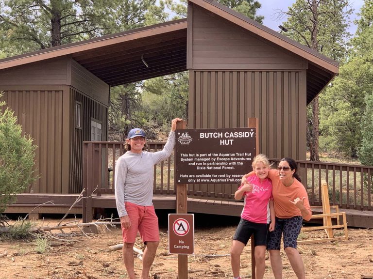
Butch Cassidy Hut

Elevation: 8034 ft.
Season: May 1 – End of October
About the Area:
While exploring Red Canyon, you can enjoy the beauty of hoodoos and infrequently traveled trails that follow in the footsteps of one of Utah’s most notorious outlaws. Get a taste of what it was like to be an outlaw in the wild west by exploring Cassidy Trail located in Red Canyon, right next to our Butch Cassidy Hut. This trail was a frequent getaway path as Cassidy and his gang avoided the posses chasing after them. This beautiful trail takes you through a miniature version of Bryce Canyon. This trail was also one of the filming areas for “Butch Cassidy and the Sundance Kid,” starring Robert Redford and Paul Newman.

Less than 20 miles from the hut you will find Bryce Canyon National Park, an alpine forest with as many red rock hoodoos as trees. At Bryce Canyon, most days afford no less than a 90-mile view to Navajo Mountain and the Kaibab Plateau in Northern Arizona. Though on especially clear days, the Black Mesas of eastern Arizona and western New Mexico come into view. Despite its name, Bryce is not actually technically a canyon, but rather a series of 14 magnificent amphitheatres 1,000 feet deep, each lined with rock sculptures. Stargazers will enjoy a 7.3-magnitude night sky; this means you’ll be able to see upwards of 7500 stars without a telescope! Compare that to the big city norm of maybe a few dozen.

Butch Cassidy Hut | View Trails and Routes

Pine Lake Hut

Elevation: 8385 ft.
Season: June 1 – Mid October
About the Area:
Just a short mile from the hut you will find Pine Lake situated at the foot of beautifully forested peaks banded with red and white layers of sandstone, located high on the Colorado Plateau at an elevation of 8,100 feet.

In 1869, the famed expeditioner, John Wesley Powell, led a crew of mountain men and former soldiers 1,000 miles down the Green and Colorado rivers. Their goal was to explore the final “blank spots” left on the U.S map. On this journey they traveled to what is now known as the Dixie National Forest and discovered the beautiful pink limestone ledges of Powell Point, reaching 10,188 feet with superb views. Imagine the exultation of John Wesley Powell and his crew when they, too, gazed from this divine perch for the first time in 1872. Geologist Clarence Dutton, Powell’s protégé, described the Point as “. . . the aspect of a vast Acropolis crowned with a Parthenon.”

Aquarius Trail Pine Lake Hut
Pine Lake Hut | View Trails and Routes

Aquarius Hut

Elevation: 10,023 ft.
Season: July 1 – Mid October
About the Area:
The Aquarius Plateau is the highest timbered plateau in North America, peaking at 11,328 feet at Bluebell Knoll on Boulder Mountain. Running for about 100 miles along the northern edge of the Grand Staircase, the Aquarius Plateau encompasses more than 900 square miles. Dense aspen, spruce and fir forests, subalpine grasslands and meadows make up the landscape at the highest elevations. Ponderosa pine forests are found at the middle elevations, and pinyon and juniper pine forests thrive at the Aquarius Plateau’s lowest elevations around 5,000 to 6,000 feet.

The Barker Reservoir is located in an aspen-spruce forest above 9,000 feet in elevation. The Department of Wildlife Resourses of Utah (DWR) stocks this lake with Brook Trout. There are several lakes for fishing surrounding the reservoir including Flat Lake, Yellow Lake, Joe Lay Reservoir, Blue Lake, Lower Barker Reservoir, and Dougherty Basin.

This diverse area hosts a large variety of wildlife with healthy populations of deer, moose, and pronghorn antelope.

Aquarius Trail Aquarius Hut
Aquarius Hut | View Trails and Routes

Hell's Backbone Hut

Elevation: 8034 ft.
Season: July 1 – Mid October
About the Area:
Death Hollow is an amazingly scenic trek that is one of the most dramatic canyons in the area, boasting an extraordinarily deep gorge and untamed wilderness that has captivated countless people throughout history. The name Death Hollow gives reference to a number of livestock that plunged to their death trying to cross the steep canyon.

Hell’s Backbone Road was constructed to serve as an alternate route between the Boulder and Escalante, and while it is reasonably well maintained, it’s still an exhilarating adventure off the beaten path that will enable you to check “Ride Hell’s Backbone” off your bucket list.

Settling into Blue Spring Ridge Camp (FS-18) on Escalante Mountain, in the summer of 1933, CCC crews established a roadway around the mountain, bridged the 800 foot deep Death Hollow Canyon with Hell’s Backbone Bridge and linked the two towns by September. Today, the 1930s wooden bridge has been replaced with a modern steel and concrete bridge, making the crossing a little less frightening. You can still see remnants of wooden beams beneath the structure and beside the road. But, back in the day, winter snows made the road impassible and residents reverted back to using wagons or pack horses through the lower canyons. It wasn’t until 1940 that an all season road linked the two towns. About mid-way along the route, you will cross the historic Hell’s Backbone Bridge, one of the most spectacular bridges in the world. This concrete deck girder bridge over Sandy Creek Gorge is 109 feet (33 m) long and 14 feet (4.3 m) wide with a 1,500-foot (460 m) drop on either side. The bridge is a must-stop for taking photographs with outstanding views down into rugged canyons. Not for the faint of heart but the views are exceptional.

The Hogsback is a portion of Highway 12 that travels over the narrow spine of a mesa with canyons on either side created by Boulder Creek and the other side is Calf Creek. Many years ago the road was one lane and traffic could only cross in one direction, but it has been widened to standard highway width and provides some of the most stunning views to be had on Highway 12.

Situated at the base of Boulder Mountain, nestled between (and within) land of the BLM, Forest Service, and Grand Staircase-Escalante National Monument, Boulder is isolated, remote, and spectacular. It has a long history of settlement, as any local resident who’s plowed a field or dug a garden can attest. Anasazi State Park was established in 1970 to preserve the record of its earliest, prehistoric inhabitants. The first white settlement began in 1889, with Boulder incorporated as a town in 1958. Boulder claims to be the last community in the continental United States to receive its mail by mule train.

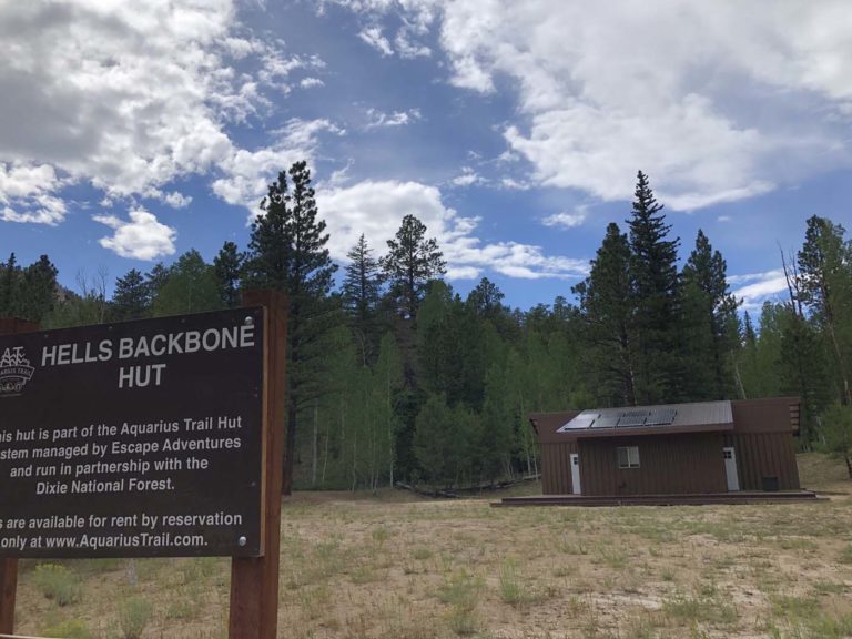
Aquarius Trail Hell's Backbone Hut
Hell's Backbone Hut | View Trails and Routes

Escalante, Utah in southern Utah is surrounded by a rugged wilderness of vast forests, towering peaks, incredible canyons, and one-of-a-kind rock formations. As the last explored territory in the continental United States, Escalante offers visitors spectacular scenery and an unmatched sense of seclusion. Located along scenic Highway 12, one of the most beautiful drives in America, Escalante is surrounded on every side by unparalleled geological wonders. To the west of Escalante along Highway 12 sits Bryce Canyon National Park with its pink-hued hoodoos and massive amphitheaters. If you follow highway 12 to the east of Escalante you will run into the stunning rotunda shaped rocks of Capitol Reef National Park and the weather beaten crags of the Waterline Fold. The area north of town is occupied by the high alpine wilderness of the Aquarius Plateau and Boulder Mountain while the south side of town hosts the rugged red rock desert canyons of the Grand Staircase-Escalante National Monument.

Pricing and Availability

We are currently taking reservations for the entire Aquarius Trail Hut System.